Tag: Hiking

  • Mt. Tammany

    Mt. Tammany

    Background Chat: 

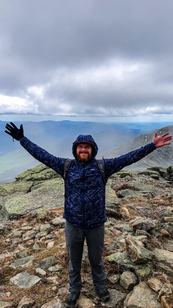
    If you’re located in Philadelphia or the surrounding suburbs, the elevation of hikes in the area is modest at best. That is why Mt. Tammany is my go-to spot for a relatively quick challenge with a view. It’s also dog-friendly, so I love to bring Merlin with me. It’s my favorite “big” hike to take him on because it’s enough for him to get his Aussie energy out but not too much that I’m over-exerting him. 

    Mt. Tammany is located in Knowlton Township, Warren County, New Jersey. It’s the southernmost peak of the Kittatinny Mountains and is part of the Appalachian Mountains. At 1,526 feet tall, it forms the eastern side of the Delaware Water Gap, with Mount Minsi across the way in Pennsylvania. 

    The hike:

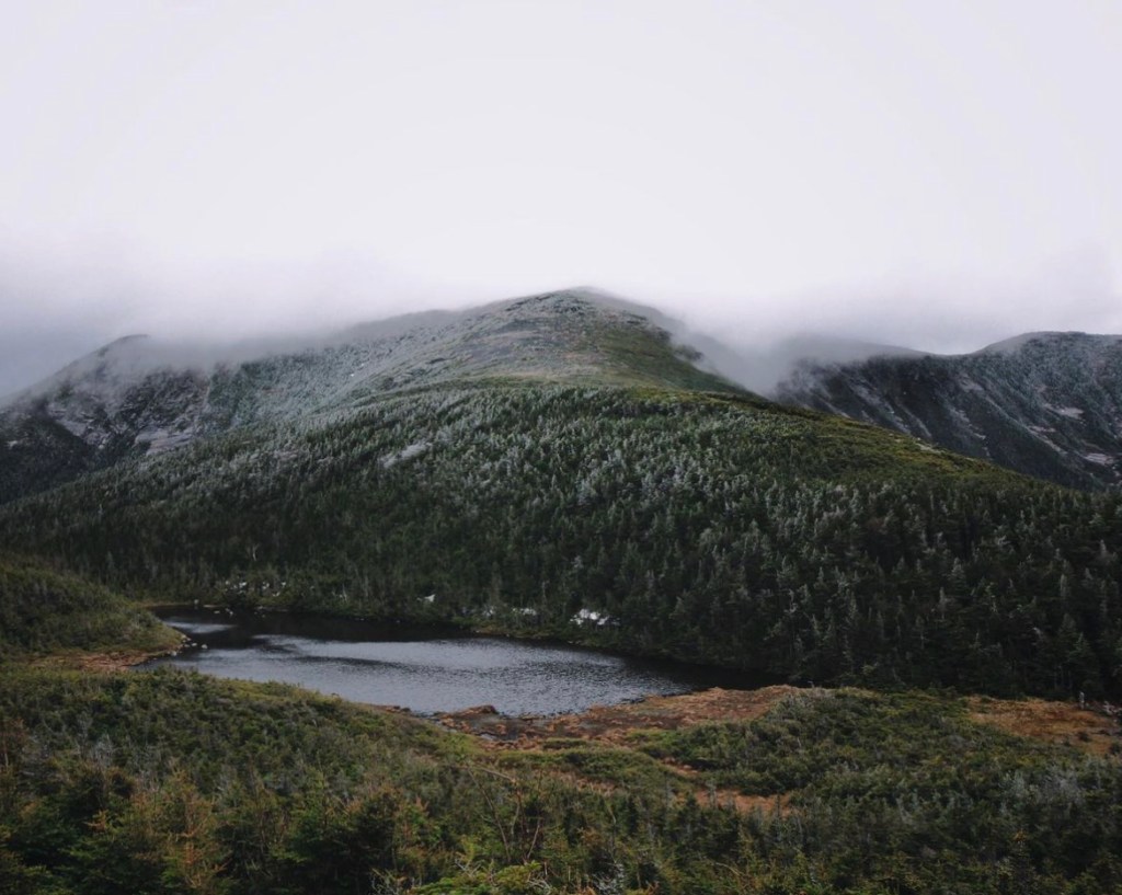
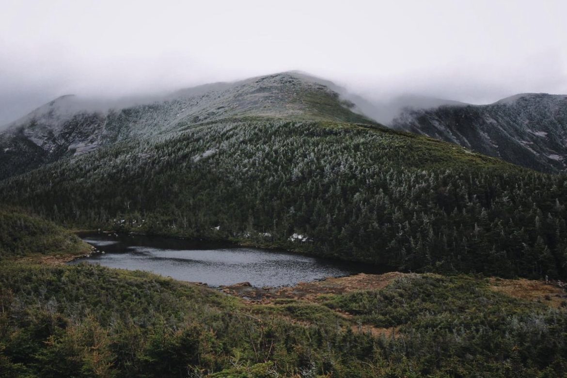
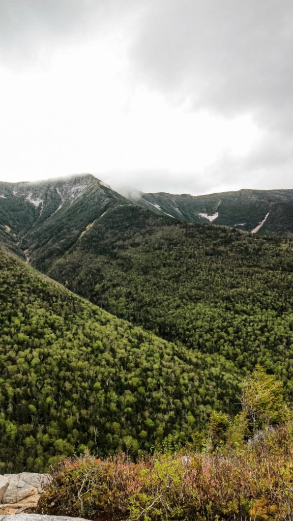
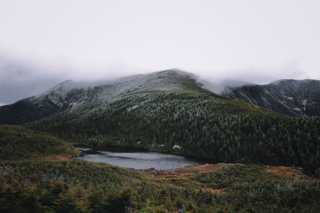
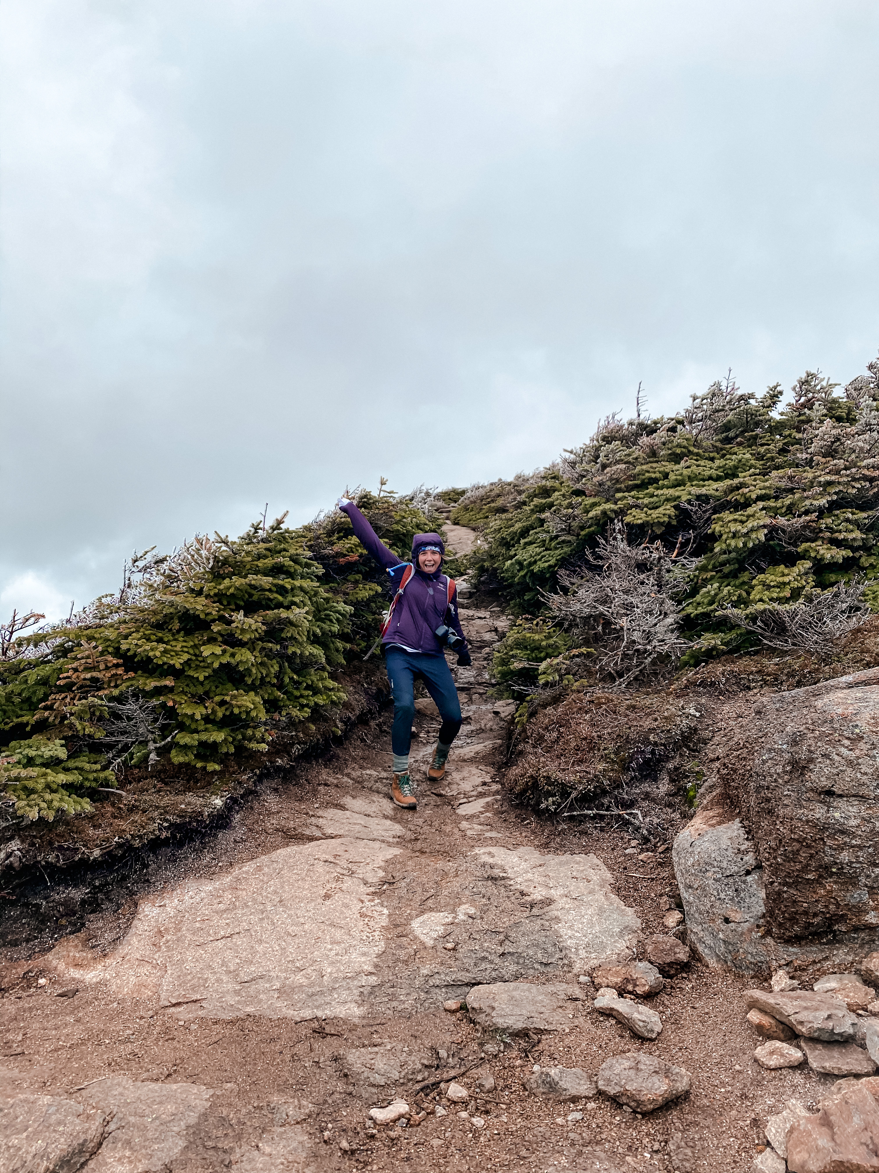
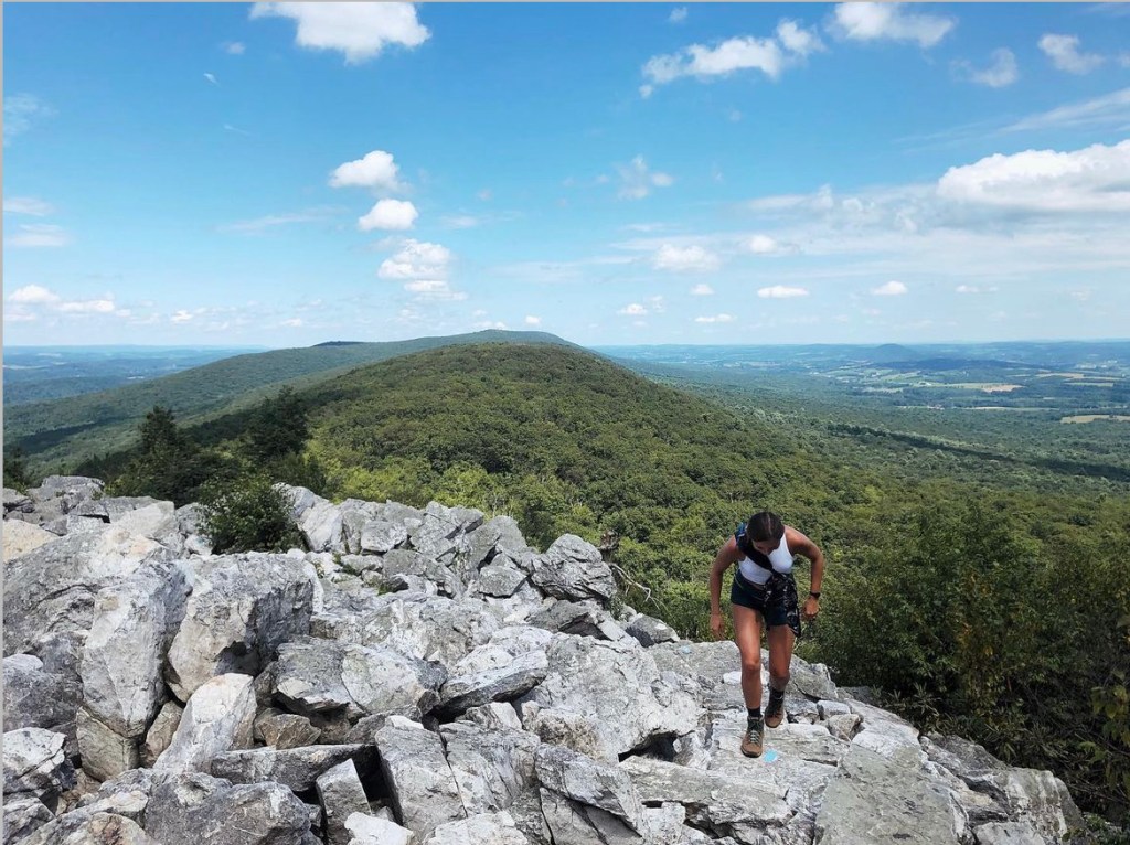
    This 3.6-mile loop can take between 2 and 4 hours to complete. It can be done in either direction, but I suggest going counter-clockwise, starting with the Red Dot Trail and ending with the Blue Dot Trail (Pahaquarry Trail). When you start, you’ll make your way up a casual incline to the iconic viewpoint. It overlooks the Delaware River and Mt. Tammany’s sibling, Mt. Minsi. 

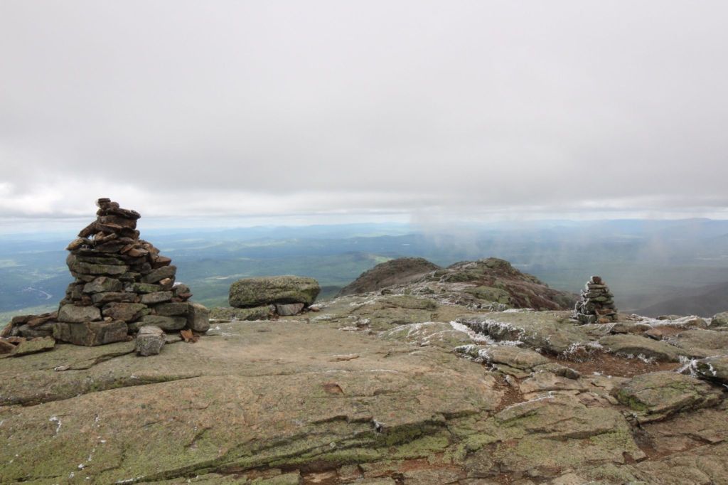
    Then, you’ll continue onward and upward, eventually meeting a section that requires scrambling up a steep rock face. In my opinion, this scramble is best done going uphill. Shortly after, you’ll reach the summit. Although it might be crowded depending on the day, it’s a great area to rest and grub out. I will say, don’t get your hopes up for a spectacular view, but you might still end up seeing a hawk or an eagle! 

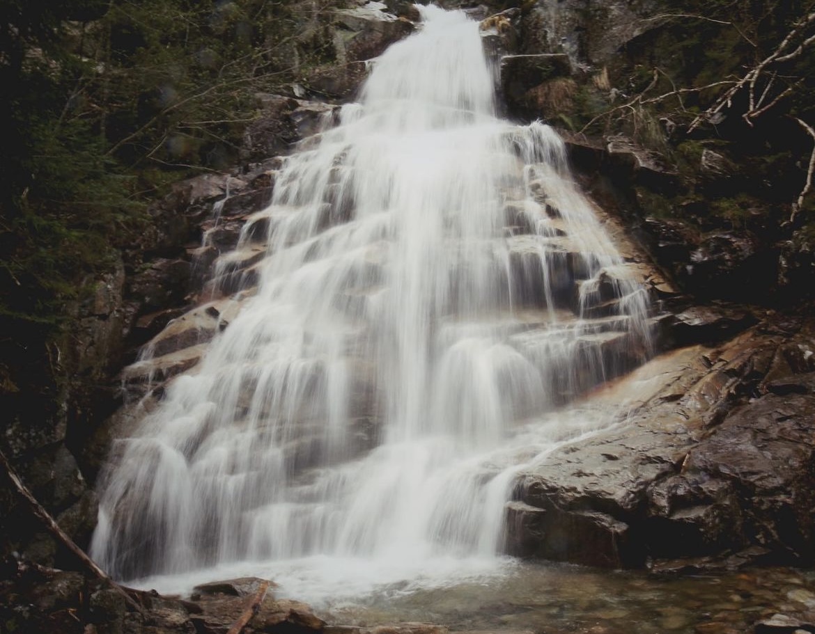
    When you’re ready to continue, you’ll begin going westward on the Blue Dot Trail. This trail is more of a gradual decline, but a long one. When no one is around, I’ll take Merlin off the leash as he loves to run down it. Eventually, you’ll pass a swimming hole and a few beautiful waterfalls. I have personally not gone swimming in the swimming hole, but I have seen people doing it and heard life jackets are recommended. 

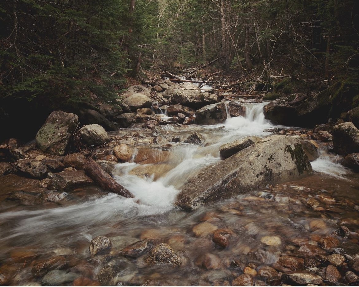
    You’ll make your way over a wooden bridge and hike along the Dunnfield Creek. This is the flat, relaxing part of the hike. Beware though, it’s pretty wet in this section. After a short walk, you’ll be back at the parking area! 

    Alternatives when you’re in the area: 

    If you’re looking for something shorter, you can always skip Mt. Tammany and walk along Dunnfield Creek to the swimming hole. Just follow signs for the Blue Dot Trail (Pahaquarry Trail) or Dunnfield Creek. You can also stop at the Kittatinny Point Visitor Center and walk along the Delaware River. There are picnic tables and plenty of green spaces for relaxing.

    Getting there:

    It’s about 1 hour and 45 minutes from where I live in PA and about 2 hours from Philadelphia. You drive through adorable towns and beautiful landscapes, making it worth the drive. Put on a good podcast or playlist, grab a snack, enjoy a bevy, and mentally prep for a hike that’ll leave you feeling you accomplished.

    There are a few areas to park that are all easily accessible right off of Interstate 80. There are two lots, one for the Dunfield Creek Natural Area Trailhead and one specifically for the Red Dot Trail. Follow signs for the Dunnfield Creek Trailhead parking area. If those are full, you can also park at the Kittatinny Point Visitor Center. 

    These lots can fill up quickly on warm weekends, so it’s best to arrive early (before 11 am) or after 3 pm. If you go later, please make sure you are equipped to return to your car in the dark, depending on the time of year you go or how late you plan on staying.

    Helpful tips:

    • Hiker shuttle: If you can’t find parking or want to make a full day trip of your time in the Gap, there is a shuttle service. I have not taken it before, but you can learn more about the Connector Shuttle service on the Go MCTA website. For quick reference, here’s the map and transit schedule.
    • Restrooms: As of August 2023, there were porta-potties at the Dunfield Creek Natural Area Trailhead. Although the Kittatinny Point Visitor Center is closed, the toilets there are open. 
    • Rest stop: The Delaware Water Gap Travel Plaza is on Rt. 80 W, about 5 minutes from the trailhead.
    • Trekking poles: These aren’t necessary, but if you find them helpful, go for it! This is a great hike to get acclimated to rocky terrain, build endurance, or for conditioning.

  • Franconia Ridge Loop

    Franconia Ridge Loop

    My first time hiking the Franconia Ridge Loop was May 31, 2020. It was at the height of COVID-19, and I had recently been laid off from my job working for an international NGO/education exchange organization in Vermont. In the same week that I was laid off, I was also broken up with and my uncle passed away. 

    Although it was a challenging time, I felt like doors had opened for me. I wasn’t necessarily in love with my job, the town I lived in, or even happy in my relationship. What happened was life giving me the push I needed to say goodbye to the parts of my life I had outgrown (minus my uncle’s passing—miss you, Uncle Bob). It was time for me to set forth on a new path. 

    Thankfully, I had an awesome landlord who understood my concern about being able to make rent payments amid a global pandemic and unemployment. He let me end my lease early on July 1 so I could move back to Pennsylvania and in with my parents. 

    My time in New England was now limited. When I first moved to Vermont, I told myself I would get into hiking, but nearly two years later, I still hadn’t made time to explore it much or the nearby White Mountains. It was truly now, or who knows when. 

    I started searching for hikes that would help me gain a sense of accomplishment, disconnect from the world, and teach me something about myself. My brother is a fairly experienced mountaineer and spoke highly of his times hiking the Presidential Traverse. After doing my own research, I knew I wanted to tackle it that summer. I told my brother about my goal and he suggested the Franconia Ridge Loop as a starting point.

    I made the 2-ish hour drive starting at 7am from Brattleboro, VT to Franconia Notch, NH. We met at the Bridle Path Falling Waters Trailhead and the parking lot was pretty packed. If you get there and can’t find a spot, there is another lot across the street at the Lafayette Place Campground. Almost right when we got there, shortly after 9am, we took off.  

    The complete loop encompasses the Old Bridle Path, Greenleaf, Franconia Ridge, and Falling Waters trails, along with three peaks, Mt. Lafayette, Mt. Lincoln and Little Haystack. We started clockwise, going up the Old Bridle Path for a more gradual uphill start and to enjoy the 3 waterfalls on the way back.

    It was a muggy but chilly start. Conditions were cloudy with a high for the day around 60 degrees. The trail can be difficult, especially in May, with patches of snow, slippery sections and high river crossings. We packed Microspikes in our daypacks just to be safe but thankfully, didn’t end up needing them.

    The Old Bridle Path is a 3-mile long trail that will bring you to the GreenLeaf Hut. While ascending the Old Bridle Path, you’ll encounter remarkable vantage points of Mt. Lincoln and Mt. Lafayette.

    The first two miles of the trail are fairly gradual, allowing for a quicker start. The final mile of the trail is steep, with large granite rock slabs and boulders. This is the section that if conditions are slick, you will want to proceed with caution. Old Bridle Path will bring you to the GreenLeaf Hut and if it’s open, stop by to refill water or purchase baked goods and snacks. 

    As we got closer to the hut, the winds started to pick up and temperatures started to drop. Since it was during the pandemic, the hut was closed, but we sat on a bench with the hut blocking us from the wind. We fueled up with sport beans, cosmic brownies and pepperoni. We put on an additional layer under our jackets. My brother didn’t bring a pair of gloves but I did, and boy was I happy I did. 

    At the hut, Old Bridle Path turns into the Greenleaf trail. You’ll continue on that for about 1 mile until you hit Mt. Lafayette. The Greenleaf Trail is faily rocky and can be a steep ascent that’s mostly exposed. You’ll begin to see rocks and Carins burried in rime—a type of ice that forms when the moisture in fog freezes suddenly on an object. 

     Once you hit Mt. Lafayette, you’ll be on the Franconia Ridge and above the tree line for more than a mile and a half. You’ll be exposed to the elements, which is why the Franconia Ridge is not only known for it’s breathtaking views of the Pemigewasset Wilderness, but also for its treacherous weather. I ended up lending my brother one of my gloves to give him a little more protection against the elements. The Ridge offers a bit of a break from steep ascents and descents but does host a few scrambly spots. You’ll continue on it until you hit Mt. Lincoln and then Little Haystack. You’ll also find some great photo op spots.

    From Little Haystack, you’ll start the steep descent down the Falling Waters Trail. The hardest section is relatively short and happens at the start of mile 7. It’s steep switchbacks that for us, were actually very slick. We moved slow and steady. I didn’t bring trekking poles at the time (I didn’t own them then) but they would’ve been very helpful. 

    We passed a few adventurers struggling to make their way up the Falling Waters Trail. It was about 1:15pm and they were dressed in jeans, Uggs and sweatshirts. Since they still had about 6-7 miles left and weren’t dressed for the hearty elements that awaited them, we advised them to turn back. Uggs offer little to no traction and although it is a gorgeous hike, it’s not worth anyone’s life. If you do find yourself in a sticky situation, and a rescue is needed, you’re also putting additional lives in danger. 

    The last 1.5 miles were very relaxing. We enjoyed the 3 waterfalls-Stairs, Swiftwater and Cloudland falls. There are a few river crossings that if you’re tired or there’s been heavy rains, can be tricky. I wanted to grab some photo’s of the falls and actually ended up slipping on a rock and into the water. Thankfully, it was shallow and I managed to stay pretty dry. The final 0.2 miles of the hike rejoin with the Old Bridle Path. You’ll continue down it until you hit the parking lot. 

    What I wore: 

    • Camelbak Cloud Walker 18 liter pack (old version)
    • Arc’teryx Atom LT Hoody (2018 version)
    • Wore 1 base layer to start
    • Columbia Montrail Windproof Pants (they don’t make these anymore but REI has some good alternatives)
    • Wool headband
    • Wool socks
    • Danner 600
    • 2L of water in a hydration bladder

    What I packed:

    • Extra mid-layer
    • 1 pair of gloves
    • Safety blanket
    • Extra pair of socks
    • Comfy shoes for post-hike drive (left in car)
    • Snacks: Sportbeans, cosmic brownie, pepperoni, and dried fruit

    Would’ve been helpful to have: 

    • Trekking poles
    • Hand warmers

    Friendly tidbits:

    • Always check the weather in the Whites. It’s notorious for rapid changes in weather conditions.
    • Always start a little chilly, attire-wise. You will heat up, and you don’t want your warm layers to get wet with sweat.
    • Interested in the 4k footers club? Mt. Lafayette and Mt. Lincoln count!
    • Pets are allowed. Please be realistic and aware of the weather and steep terrain.
    • As always, leave no trace. Pack out what you pack in.
    • Smiles over miles (: Know your limits!

    Greanleaf Hut (as of May 2024):  

    • Full-Service: May 30, 2024 – October 19, 2024
    • Self-Service: May 16, 2024 – May 26, 2024
    • Closed during the fall, winter, and much of the spring. The hut cannot be used as an emergency shelter during the winter.

    Parking: 

    • In Google Maps, searching for “Old Bridle Path trailhead” should bring you to the correct spot (GPS coordinates: 44°08’31.8″N 71°40’53.6″W).
    • Across Route 93 is Lafayette Place Parking, an alternative parking area if the Trailhead parking is full.
    • There is also a hiker shuttle that runs to the trailhead from the Peabody Big Lot for a small, cash-only, fee. More information can be found on the Franconia Notch State Park website.

    The FRL would, Coming soon! Stay Tuned!

  • Hawk Mountain

    Hawk Mountain

    Hamburg, PA | Difficulty: Moderate – Hard

    Your board requires just a little bit of upkeep to make sure it’s safe and keeping you moving. This maintenance is not difficult to learn.